The (Geo-)spatial Bone implements proximity searches. It provides a somewhat efficient way to retrieve entities,
which are closest to a given point. Our algorithm is based on two assumptions:
The region we’re searching is small enough to ignore errors introduced by transferring the spherical earth surface
into a flat map. This means you cannot search the whole world. Your data must be limited to a
region/country/continent.
The region is larger than the actual area of interest. This means that there’s a predefined limit on distance, in
which results are useful. It’s okay to discard results outside of this limit, even if they would have been the
closest ones.
.. Example:
IfyouqueryyourapplicationtothenextPub,youmightexpectresultswithinarangeof100km.APubin500kmdistancewouldprobablybeuselesstoyou-evenifitwouldbetheclosestone,soit's okay if thisalgorithmdoesn't find it.
Use this bone only if your use-case meet these assumptions!
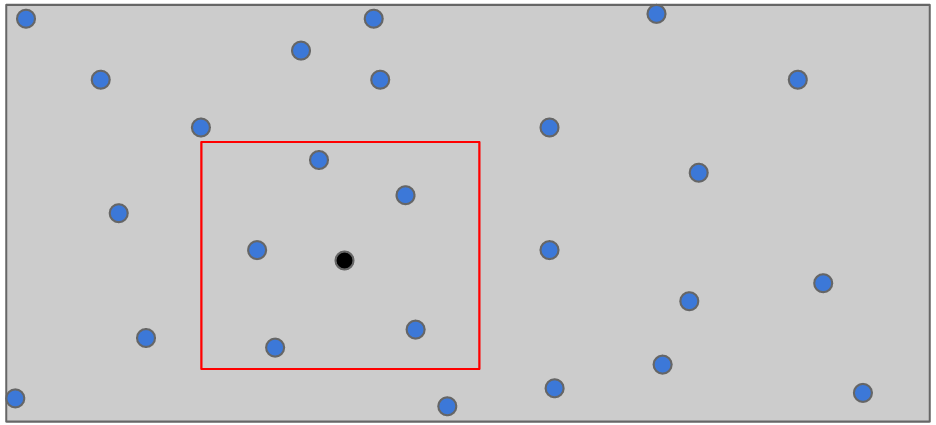
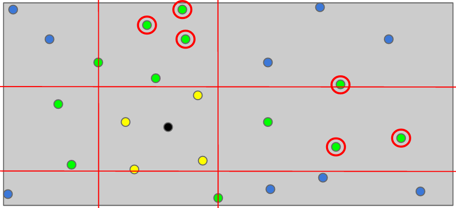
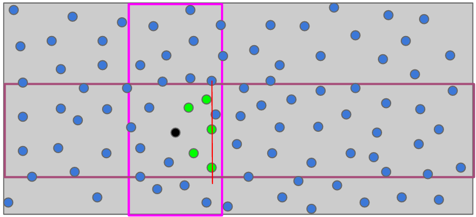
Lets assume we have a very sparse map, got a point somewhere inside and want to get the entries close around.
A sparse map, our position and the elements close around
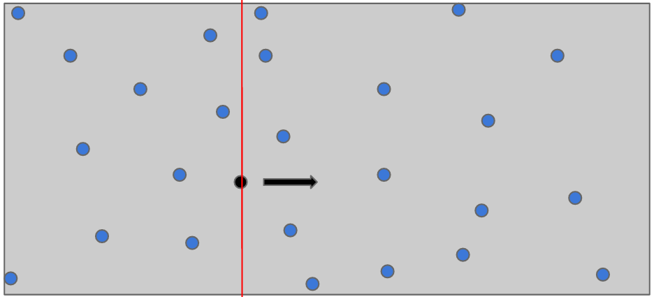
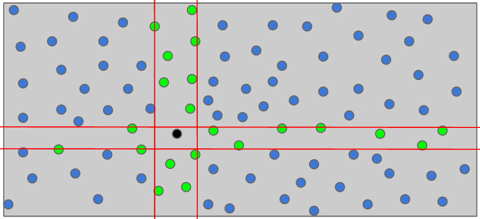
Our algorithm uses a sweepline to fetch the points close to the given position. So one subquery is performed for each
possible direction on the map (North/South/East/West), which fetches the next n Points in the given direction
Lets assume we have a very sparse map, got a point somewhere inside and want to get the entries close around.
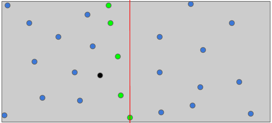
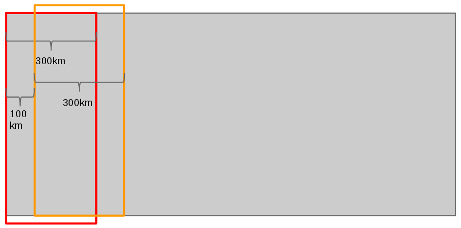
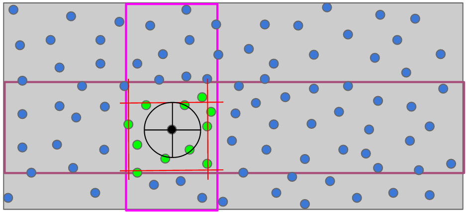
This is where the second assumpion comes in hand.
We split the map into alleys that are three times wider than the limit on distance that we’ll consider. So if your
use-case requires a distance up to 100km, a alley will be roughly 300km width/height.
Allys will overlap (an ally will start each 100km)
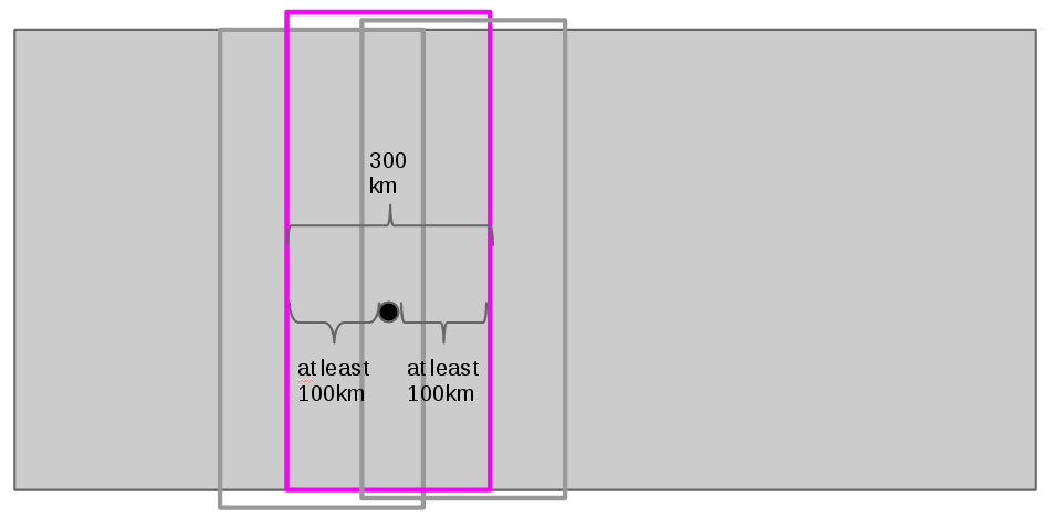
This has two implications. First, every point lies within up to three allys. And there is always at least one ally,
which boarders have at least 100km distance to the given point.
Ally, which borders are at least 100km distance to the given point
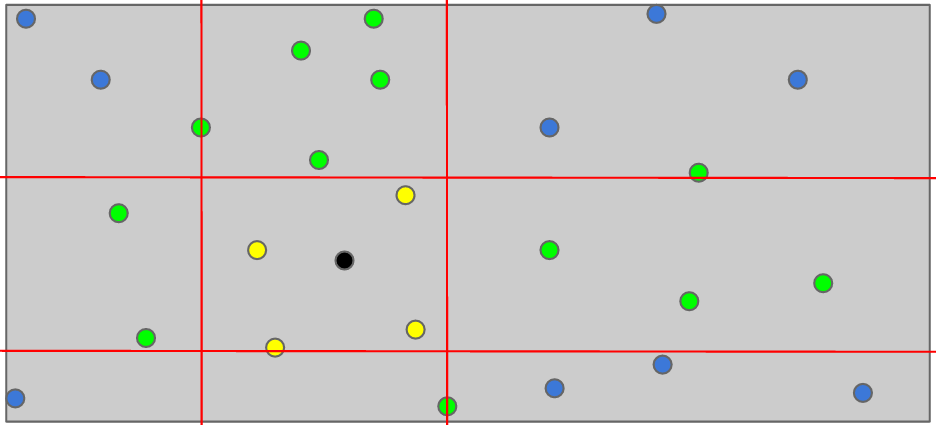
Now its possible to limit the sweepline to points inside this special ally. If apply this alleys on both directions
we can limit each sweepline to ignore points outside the area of interest.
After running all four sweeplines we can sort the fetched results by distance and we can determine the guranteed
correctness, ie. the distance for which we can prove that there can’t be any points we’ve missed.
Our algorithm may return points further away, but there might be points in between which we could have missed.
Size of the minimum guranteed correctness distance